Fine late 18th century English manuscript atlas beautifully drawn, almost certainly by a child, and offering 68 full-page maps, 32 in outline and a further 36 with keyed explanatory apparatus.
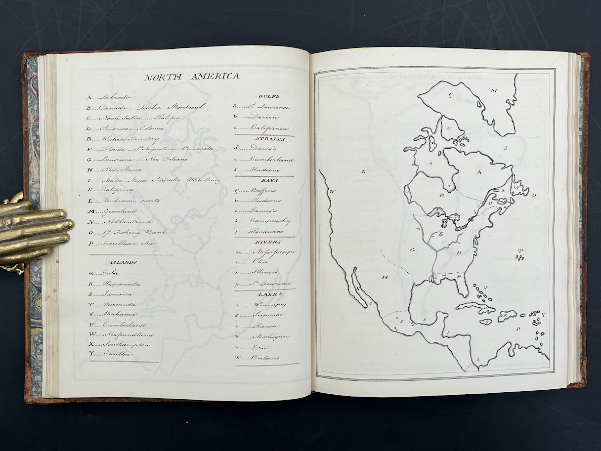
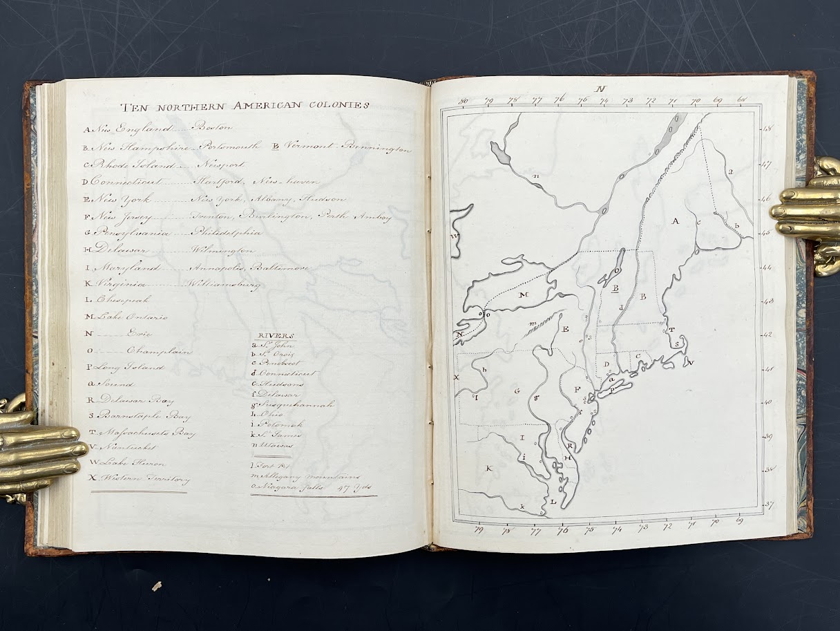
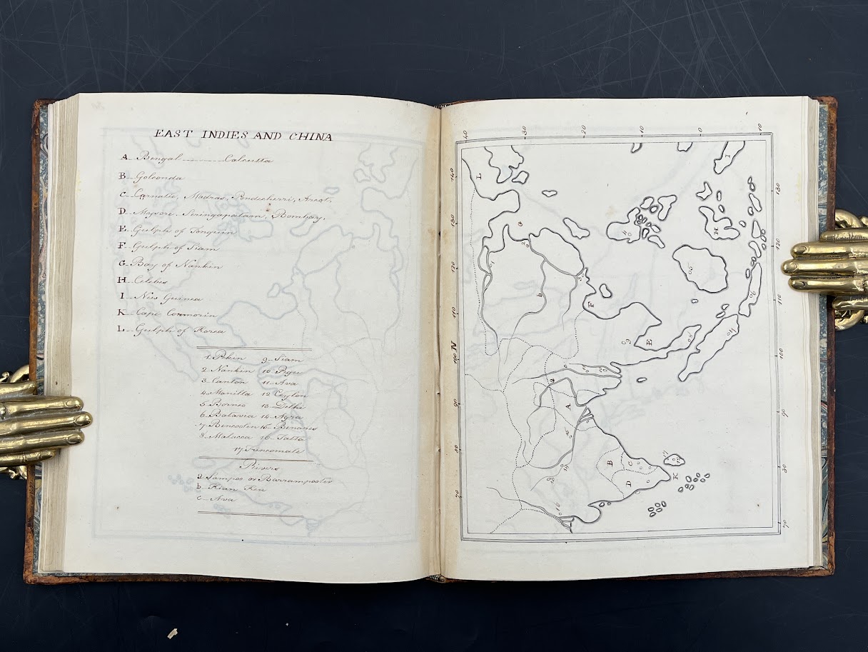
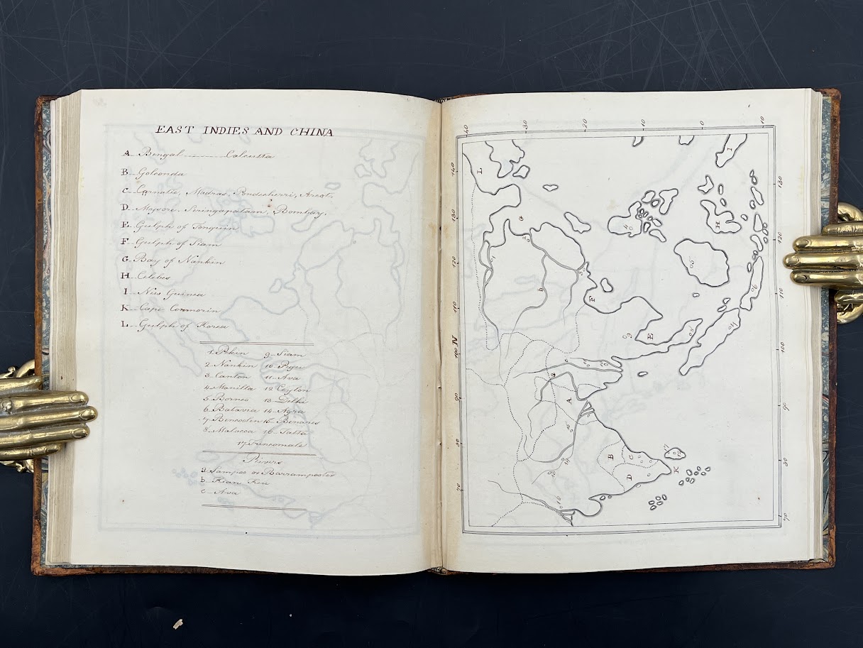
The manuscript’s creator, probably in or around London, details a colonial-era map of North America (California as peninsular) entitled ‘Ten Northern American Colonies’ (going no further south than Virginia) as well as providing maps of the ‘East Indies and China’ and a further ‘Epitome of the new World’ - north and south America as well as maps of England and Europe. We have not identified which printed map of the American colonies ‘M.L.S.’ was working from.
This manuscript atlas is a particularly good example of its kind. The only English county to have its own full map is Middlesex - hence the suggestion of a London origin to the manuscript. The presence of maps of legal circuits in England may suggest a lawyerly family background.
Map drawing for children in the 18th century was part of a polite education - the kind undertaken by the Bertram children in Jane Austen’s Mansfield Park - and in Britain functioned as a way of understanding imperial expansion (and contraction if it were to be acknowledged in the years after 1776).
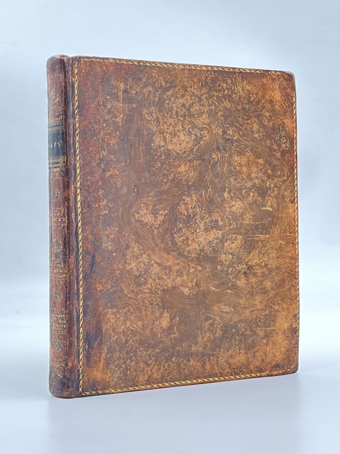
These maps could demonstrate and develop (as here) the child’s skilled draughtsmanship in the copying process, which would have drawn upon printed examples available to the child or their tutor. And when completed the atlas could be retained to demonstrate the child’s educational achievement - certainly the family involved in the production of this atlas approved of the outcome as they commissioned its attractive tree-calf binding after the manuscript was completed.
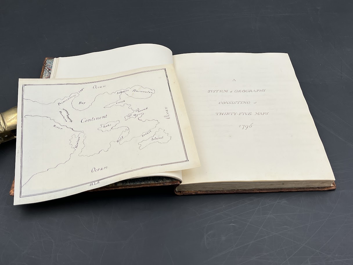
DESCRIPTION: Attractively bound quarto size manuscript (19x24cm) in tree calf, spine relaid, gilt sun emblems to the backstrip and ‘Maps’ on a black label. Marbled endpapers; paper with ‘GR’ watermark and horizontal chainlnes. Written on the the second flyleaf, the initials ‘MLS’. Manuscript title: ‘A System of Geography Consisting of Thirty-Five Maps 1796’ (no printed analogue to this located). A ‘Contents’ page follows the title, offering a diagram of ‘Circles’ followed by the 35 maps that cover Europe, the Americas (North America and South America), Ireland, Scotland, 6 maps of the legal circuits in England, the ‘War on the Rhine’, concluding with ‘East Indies and China’, West Indies, and ‘Epitome of the Old World’, ‘of the New World’, ‘of England’. Maps drawn in ink on the rectos and explanatory details opposite. Maps 1-32 are each presented twice. The first version presents the topographical outline only; the second also has the apparatus and key. The three epitome maps (33-35) are presented once only with full apparatus. An additional map on watermarked paper from 1800 and also initialled ‘M.L.S.’ is also laid in. The manuscript runs to [pp] 144 plus a single leaf laid in & terminal blanks.